

Combination MH Poly – GEO2: consultants and supervisors site preparation Waterrijk in Boskoop
Project description
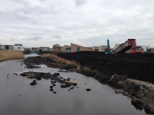
Project “Waterrijk” consists of, among other things, the site preparation of ca. 15,5 ha of land at the southwest of the centre of Boskoop. The site is characterized by its long strips of fields, separated by canals, also called ‘Slagenlandschap’. The site preparation takes place in a traditional way, by digging out peat, filling it up with soil and further levelling up with sand. Firstly the layer of 4 meters of peat will be unearthed. This layer will be filled up with soil. On top of this layer the surface layer will be applied. By adding sand, a temporary extra elevation is created. By applying this method a less thick layer of sand is required and the sublayer is more stable.
Project activities
For the development of the project “Waterrijk” MH Poly and GEO2 were asked to write a (concept) plan for the geotechnical monitoring during the execution of the site preparation. The monitoring serves several purposes. Firstly it can be used to check if the soil settlement requirements are met. Secondly the monitoring can be used to optimize the site preparation, for instance by speeding up without creating unacceptable settlements, soil instability or damage to adjacent foundation constructions.
Recently, a survey and measurement of the actual situation of the location has been captured because of possible future liability issues. This so called ‘baseline measurement’ is executed in combination with CITE:
- Preconstruction survey inside and outside adjacent houses;
- Measurement of x-, y-, z-, coordinates of roads and bridges;
- Measurement of canal waterbeds up to 50 meters outside the project area;
- Visual inspection of roads, bridges and parts of the sheet piling in the project area.
Opdrachtgever
Waterrijk Boskoop BV
Delen